Science & Technology | Updated 2 November 2026
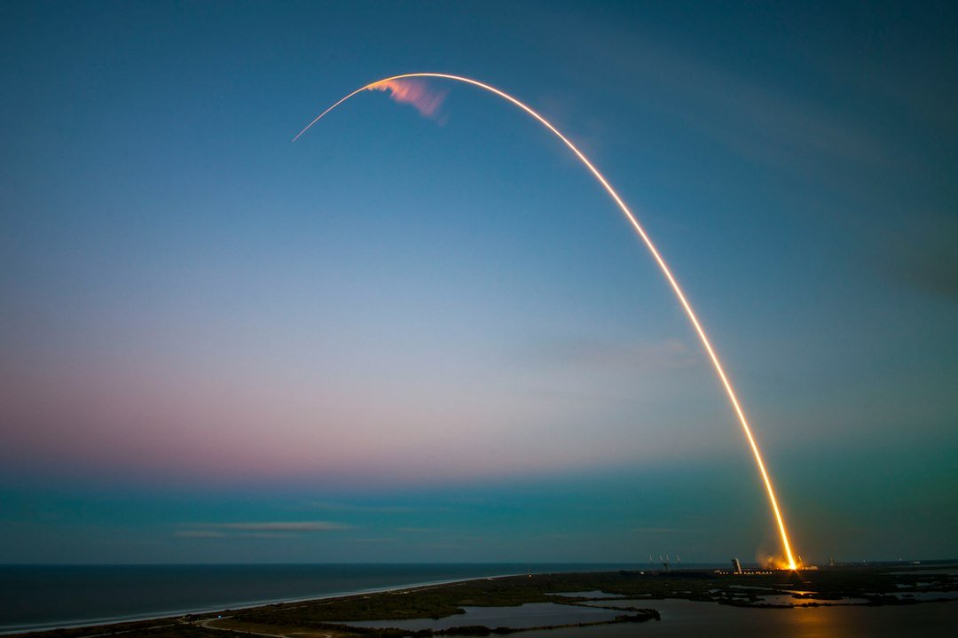
India’s satellite-navigation programme received a new spacecraft when the Indian Space Research Organisation (ISRO) successfully launched NVS-03 aboard GSLV-F18 on 30 October 2026. The mission is important not only as a launch milestone but because navigation satellites provide precise positioning, navigation and timing (PNT) services used in transport, mapping, maritime activity, emergency response and strategic applications. Understanding NVS-03 requires separating the launch vehicle, satellite, orbit and navigation system.
Mission snapshot
| Parameter | Official detail |
|---|---|
| Mission | GSLV-F18/NVS-03 |
| Launch date/time | 30 October 2026, 23:51 IST |
| Launch site | Second Launch Pad, Satish Dhawan Space Centre (SDSC SHAR), Sriharikota |
| Launch vehicle | GSLV; 20th GSLV flight |
| Initial orbit | Geosynchronous Transfer Orbit (GTO) |
| Satellite series | Third spacecraft in second-generation NVS series |
| Planned orbital slot | 111.75° East geosynchronous orbit |
| Navigation signals | L1, L5 and S bands |
What happened after launch?
ISRO reported that GSLV-F18 injected NVS-03 into an orbit of approximately 170.3 km × 38,080 km on 30 October. This is an elliptical transfer orbit, not the final geosynchronous orbit. The satellite then uses its onboard propulsion system to raise and adjust its orbit. On 31 October at 16:48 IST, the first orbit manoeuvre was completed with a Liquid Apogee Motor (LAM) burn duration of 2,174.8 seconds. ISRO estimated the post-manoeuvre orbit at 5,477.6 km × 37,833.4 km and stated that satellite health was normal. Further manoeuvres were planned to reach the 111.75° East geosynchronous slot.
The sequence matters: launch → injection into GTO → orbit-raising manoeuvres → final orbital slot → commissioning and service availability. Successful injection is a mission milestone; it does not automatically mean all navigation services from the satellite are already operational. The spacecraft must complete orbital placement, health checks, payload testing and integration with the ground segment.
GSLV-F18: launch vehicle versus satellite
GSLV stands for Geosynchronous Satellite Launch Vehicle. It is a launch vehicle developed by ISRO to place payloads into geosynchronous transfer orbit and other required trajectories. F18 denotes the flight number in the GSLV series; it is not the satellite’s name. NVS-03 is the payload—the navigation spacecraft carried by the rocket.
The launch was conducted from the Second Launch Pad at Satish Dhawan Space Centre, SHAR, Sriharikota, Andhra Pradesh. SDSC SHAR is India’s principal spaceport for orbital launches. The mission’s 20th GSLV flight is a useful static-GK fact, but remember that the number refers to GSLV flights, not all ISRO launches or the total number of satellites.
NavIC: India’s regional satellite navigation system
NavIC means Navigation with Indian Constellation. It was previously called the Indian Regional Navigation Satellite System (IRNSS). It is an independent regional satellite navigation system designed to provide position, velocity and timing information over India and a region extending approximately 1,500 km beyond the Indian boundary. Its primary service area is regional rather than global; outside that coverage, compatible multi-constellation receivers can use other GNSS systems.
NavIC has two service categories:
- Standard Positioning Service (SPS): civilian service available to users.
- Restricted Service (RS): encrypted service for authorised users and strategic applications.
ISRO describes NavIC’s intended positioning accuracy as better than 20 metres (2σ) in its primary service area, with timing accuracy specified on its navigation-services page. These are system design/service specifications, not a guarantee that every receiver in every environment will achieve the same accuracy. Buildings, terrain, signal blockage, receiver quality and atmospheric conditions affect real-world performance.
Why NVS-03 is part of a second-generation series
ISRO envisaged five next-generation navigation satellites—NVS-01 through NVS-05—to augment the NavIC base-layer constellation and support continuity of service. NVS-01, launched in May 2023, was the first second-generation satellite and carried an indigenous atomic clock. NVS-03 is the third spacecraft in this series. The series adds L1-band signals to the existing L5 and S bands, widening receiver compatibility and strengthening the civilian navigation offering.
NVS-03 carries an indigenous atomic clock as well as procured atomic clocks. Atomic clocks provide highly stable time references. Satellite navigation depends on precise timing because a receiver estimates distance from satellites by measuring how long radio signals take to travel. Small timing errors can translate into large position errors; clock stability is therefore a core navigation requirement, not an incidental payload feature.
Frequency bands: L1, L5 and S
NavIC’s signal architecture includes:
- L1: 1575.42 MHz, a widely used civilian GNSS band. NVS-generation satellites add this signal to improve interoperability with compatible receivers.
- L5: 1176.45 MHz, used for navigation signals.
- S band: around 2492–2498 MHz as specified across ISRO’s navigation pages; it is part of NavIC’s existing signal architecture.
Using more than one frequency can help receivers address ionospheric effects and support different application requirements, depending on signal design and receiver capabilities. L1 interoperability is especially relevant for consumer-device ecosystems because several global navigation systems also broadcast signals in this band. However, a device still needs suitable hardware, software and NavIC support; the presence of an L1 signal does not make every phone automatically compatible.
NavIC and global GNSS systems
NavIC is a regional system, while GPS (United States), GLONASS (Russia), Galileo (European Union) and BeiDou (China) are global navigation satellite systems. Regional systems can complement global ones. A receiver that supports multiple constellations may combine signals from NavIC and other GNSS networks to improve availability and continuity. India’s strategic rationale is to maintain an independent PNT capability for critical national applications rather than depend entirely on external navigation infrastructure.
Applications and national relevance
Navigation and timing are used in road, rail, aviation and maritime transport; vehicle tracking; surveying and geodesy; mapping; resource monitoring; scientific research; telecommunications synchronisation; disaster management; and location-based services. NavIC also has a provision for one-way short-message broadcasting, which ISRO’s FAQ notes is used for emergency warning alerts to fishermen venturing into deep sea where terrestrial connectivity may be unavailable.
Reliable domestic navigation supports strategic autonomy, resilience and continuity of essential services. The benefits depend on the entire system: space segment (satellites), ground segment (control, monitoring and timing facilities), user segment (receivers and applications), and the integration of signals into operational devices and services.
Static GK and exam revision
- NavIC: Navigation with Indian Constellation; earlier IRNSS.
- ISRO: Indian Space Research Organisation; Department of Space, Government of India.
- Launch site: SDSC SHAR, Sriharikota, Andhra Pradesh.
- GSLV-F18: 20th GSLV flight; launched NVS-03.
- NVS-03: third second-generation NVS satellite; L1/L5/S payload; indigenous atomic clock.
- Primary coverage: India plus roughly 1,500 km beyond Indian boundary.
- Services: SPS for civilian users; RS for authorised users.
- Target slot: 111.75° East geosynchronous orbit.
- GTO: elliptical transfer orbit; not the final geosynchronous orbit.
Possible MCQ areas
Prepare the full forms of NavIC, IRNSS, GSLV and GTO; launch date/time and launch site; NVS-03’s position in the NVS series; signal bands; difference between SPS and RS; the 1,500-km coverage; the 111.75° East orbital slot; and the purpose of an atomic clock and orbit-raising manoeuvre. A question may also ask why NavIC is regional while GPS/Galileo/BeiDou are global.
Related reading
Read our earlier GSLV-F17/EOS-05 mission explainer for a comparison of launch vehicle and satellite roles, the Daily Current Affairs 2 November 2026 briefing, and the Current Affairs Hub for further science and technology updates.
Official sources
- ISRO: GSLV-F18/NVS-03 mission
- ISRO: NVS-03 orbit manoeuvring update (31 October)
- ISRO: Satellite Navigation Services
- ISRO: NVS second-generation satellite series
- ISRO: NavIC applications and FAQs
- PIB: NVS-03 mission factsheet
Editorial distinction: the orbit figures above are ISRO’s reported values at the stated stages. The final geosynchronous placement and operational commissioning are subsequent steps; this article does not imply that they were complete on 2 November.